December 1, 2025
Day 90 — Kagoshima
Marilee here.
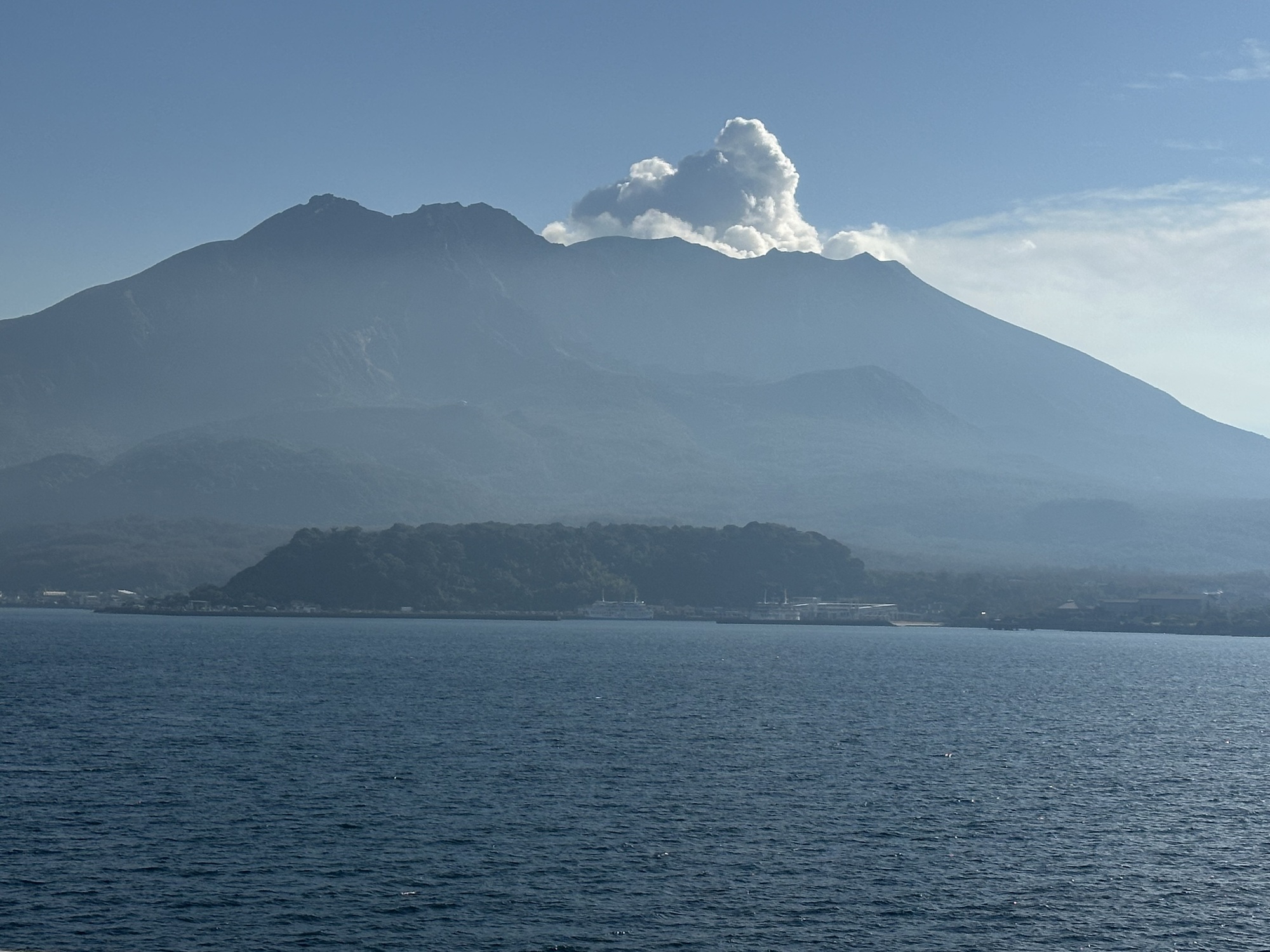
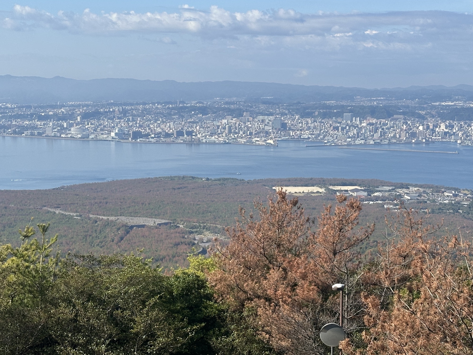
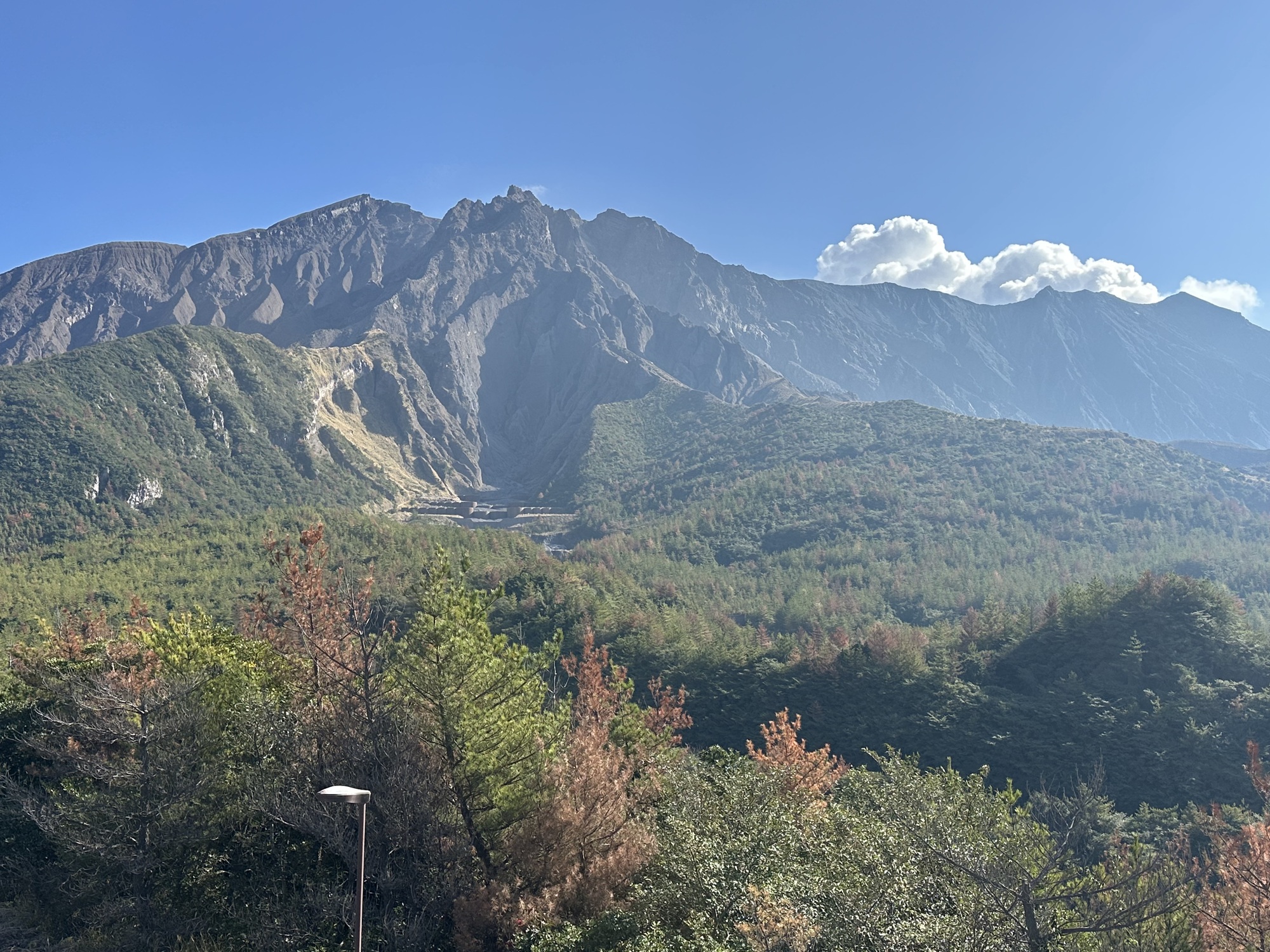
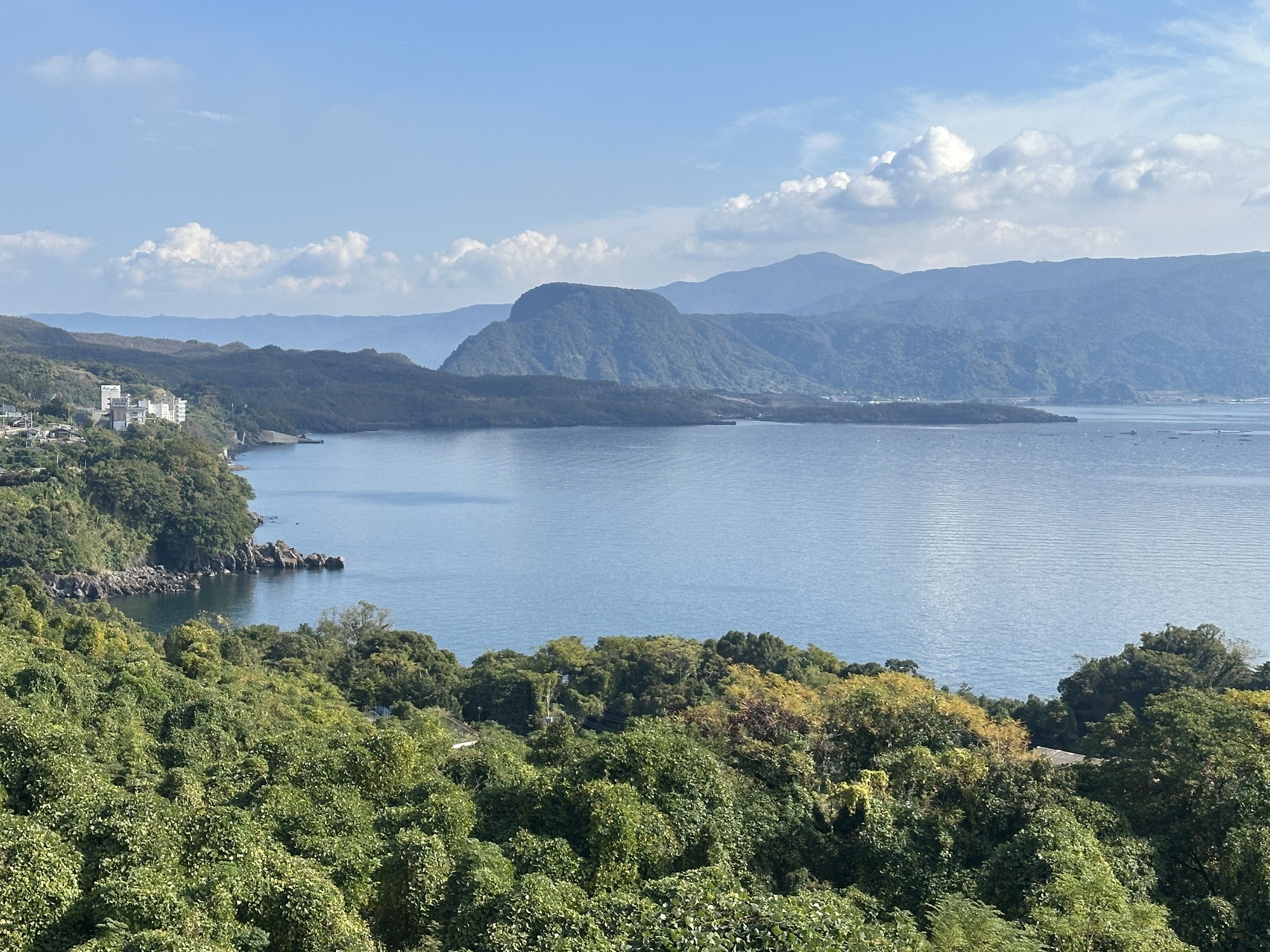
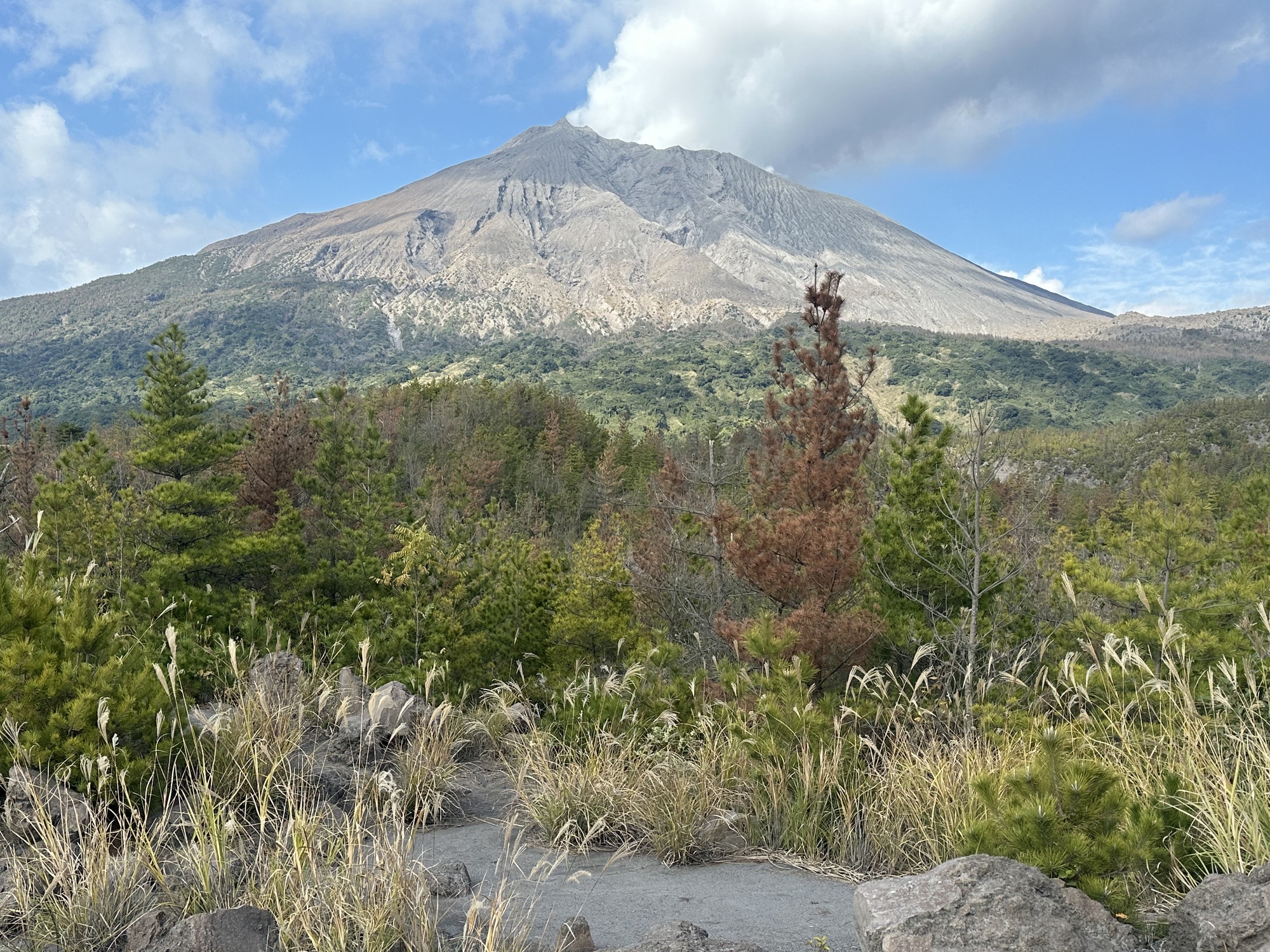
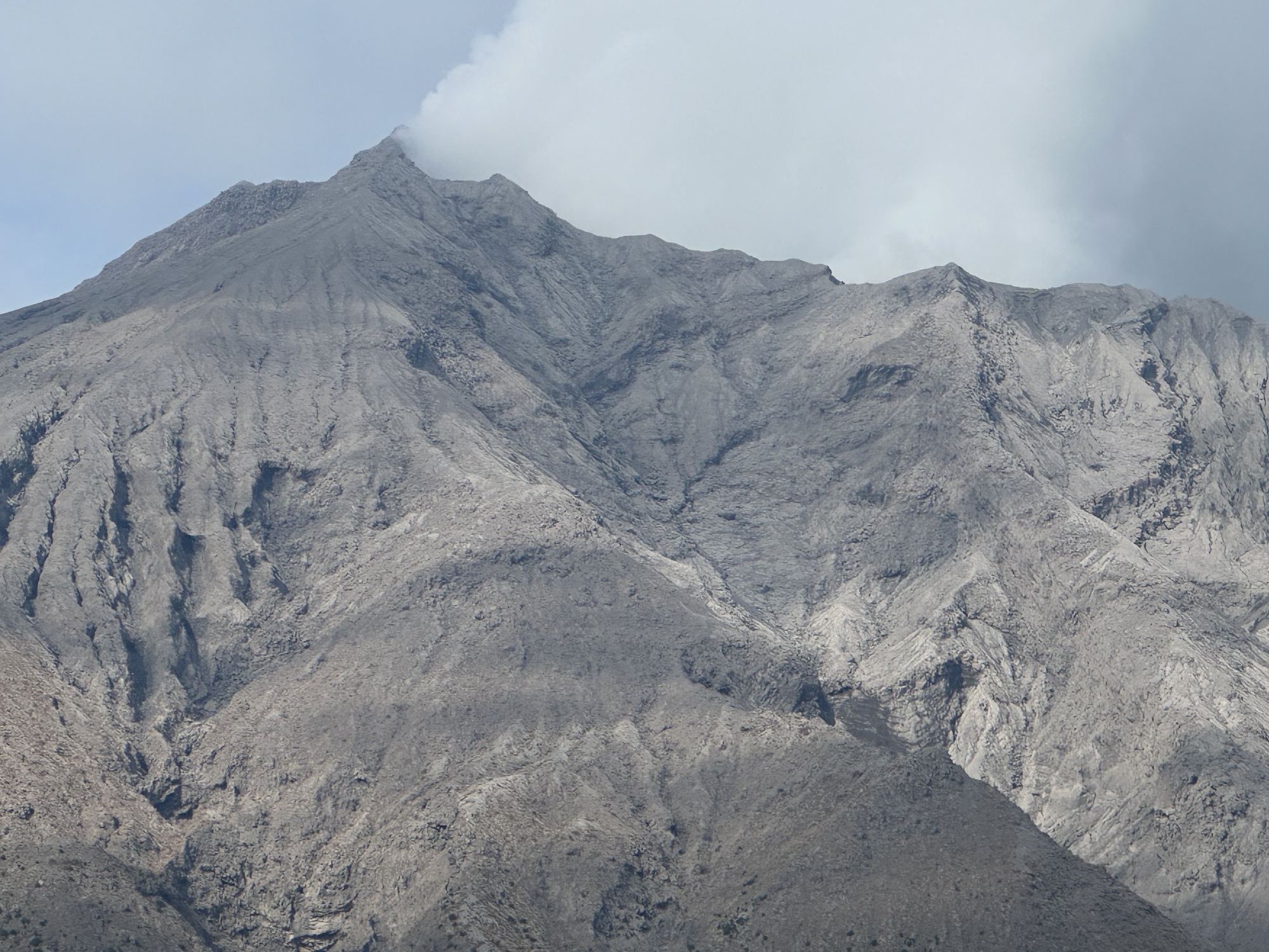
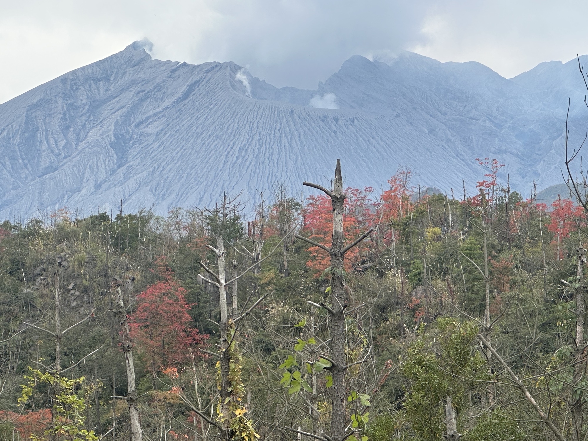
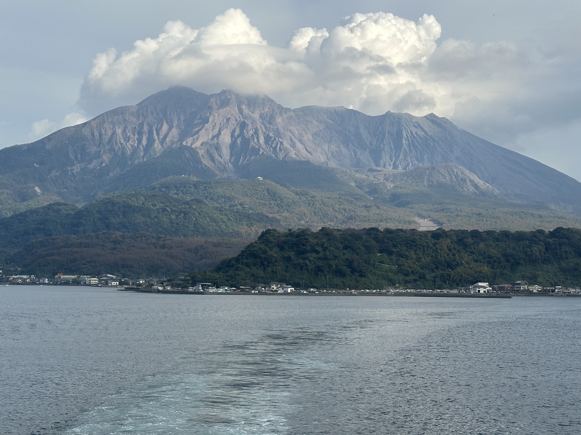
We were taking a “day off” in Kagoshima, but if you think that means no biking, well, you’d be wrong! Across the bay from the city, dominating the skyline to the east, is the bare, red, fissured cone of Sakurajima, one of the world’s most active volcanoes. And although you aren’t allowed to summit the volcano, and look down into its smoking cone, a ring road encircles its base. Riding around the volcano and checking out the evidence of past eruptions seemed like the perfect way to spend our day off.
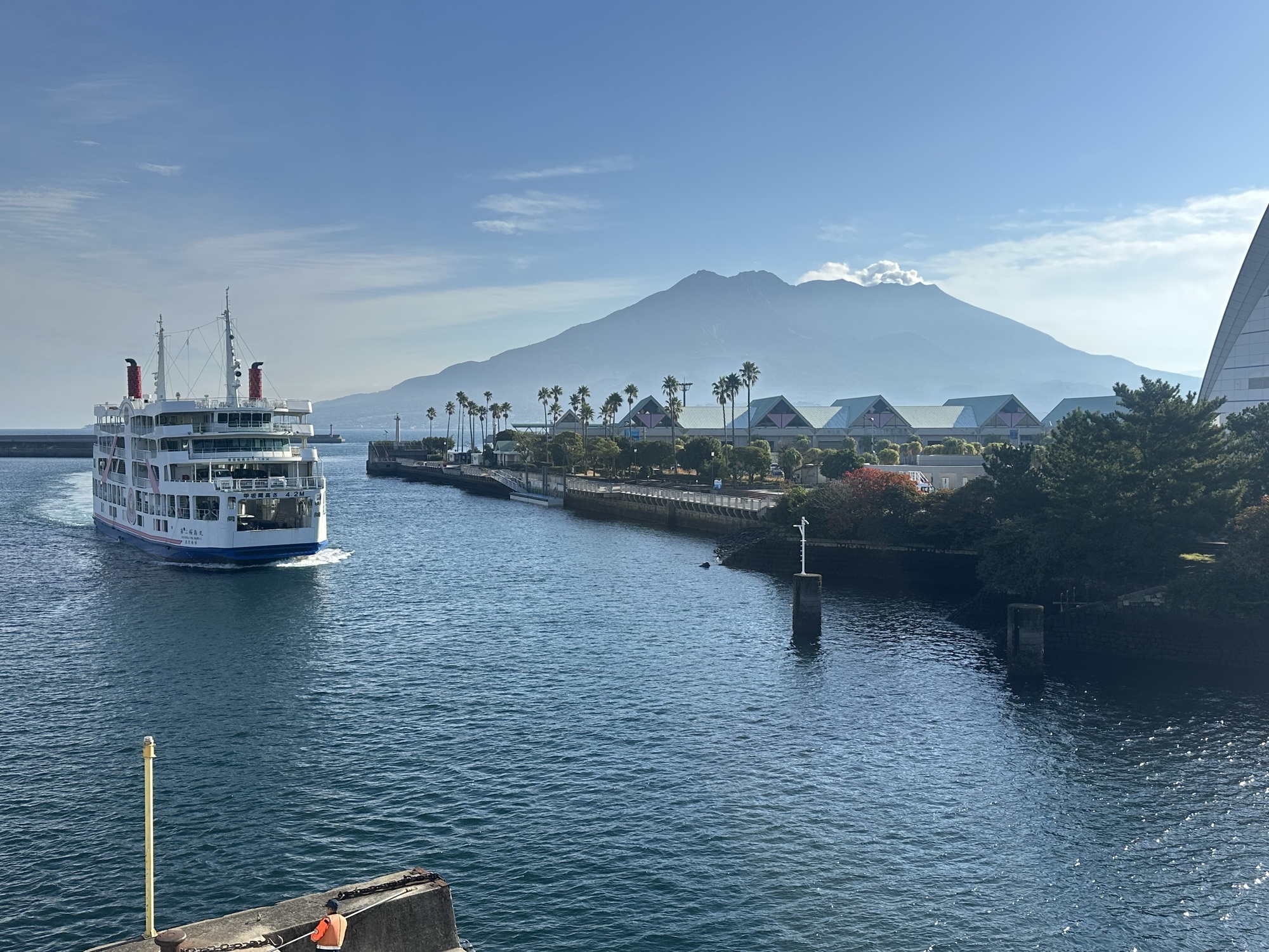
And it involved a short ferry ride, making it even more of a holiday excursion. So right after breakfast (a massive feast of scrambled eggs, bacon and fried bread— part of Tom’s weight gain plan) we set off. Setting off involved a fair amount of logistics, as we were storing our bikes in the fifth floor hallway outside our little apartment, and getting them to street level involved a slow ride in an elevator so tiny that only one bike at a time could fit, and had to be held upright on its back wheel. Then each bike had to be negotiated down a set of stairs that the caretaker had just mopped, while she lurked in the shadows and glared at us for messing up her work. But eventually we were on the road, headed for the ferry terminal.
We were only a few minutes ride from the waterfront, but as we discovered, it is lined with large buildings, any of which could be a ferry terminal (especially when you can’t read the signs). Eventually we identified the right building and a helpful traffic warden let us shortcut into the boarding lane (bikes ride on with the cars), and within minutes we were watching Kagoshima slide away.
The ferries to Sakurajima run every 15 minutes, 24 hours a day: a pretty staggering frequency, until we realized that it is a great shortcut for people trying to get to the southeastern part of Kyushu. Sakurajima used to be an island, until an eruption in 1914 connected it to the “mainland” to the east.
| Heart | 1 | Comment | 0 | Link |
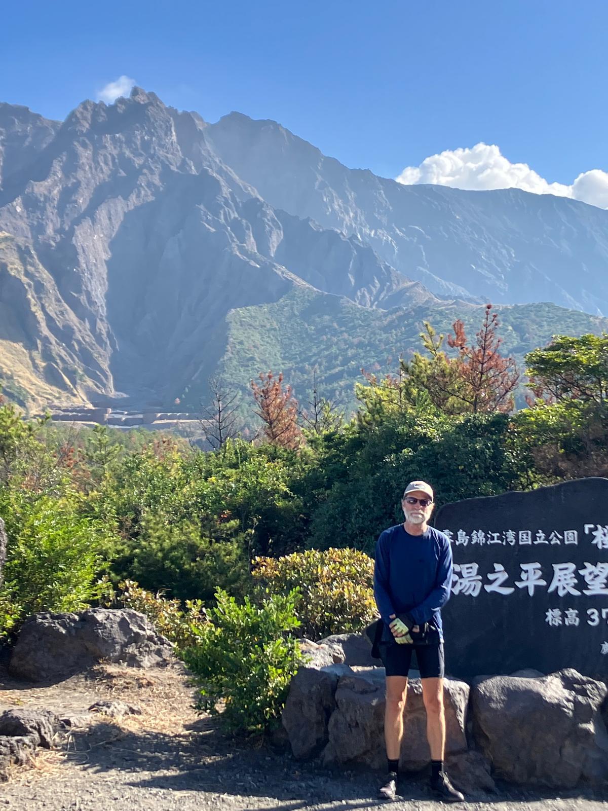
Once the ferry docked on the other side, we headed off, keen to start what we envisioned as a leisurely morning ride. A tourist map board outside the ferry terminal revealed there was an observatory platform a few kilometres away, so we decided to make that our first destination. Closer examination of our navigation apps further revealed that it was a 400 meter climb, over 5km, up to the observatory. In other words: steep! But we reasoned that the rest of the day would be pretty flat, so we headed off.
The road was indeed steep — a series of unrelenting switchbacks up, up, up to a saddle that gave us great views of the volcano. We spent a while there, admiring the view and recovering from the exertion of getting there.
| Heart | 2 | Comment | 0 | Link |
| Heart | 1 | Comment | 0 | Link |
| Heart | 0 | Comment | 0 | Link |
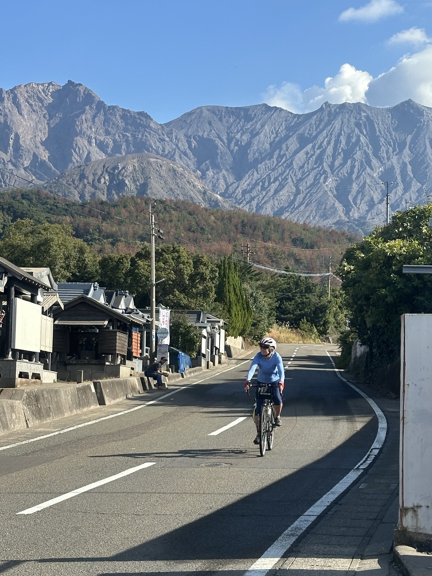
Getting down from the observatory was a lot quicker than going up, even for me and I am a chicken on steep downhills, riding my brakes around all the switchbacks that Tom sails down. Then it was onto the ring road. But wait a minute! Why are we climbing another hill? And now another one? OK, this must be the last one — oh no, this isn’t going to be quite the easy day we thought we signed up for.
Yes, to our surprise it turns out that volcanic islands are hilly.
| Heart | 0 | Comment | 0 | Link |
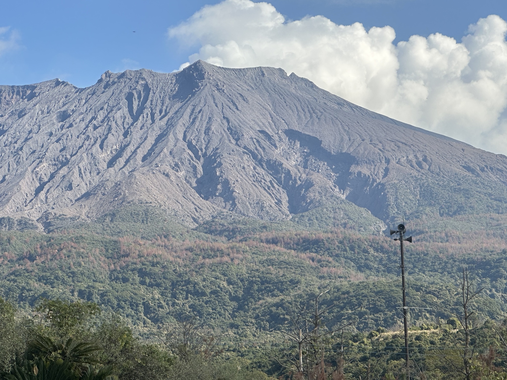
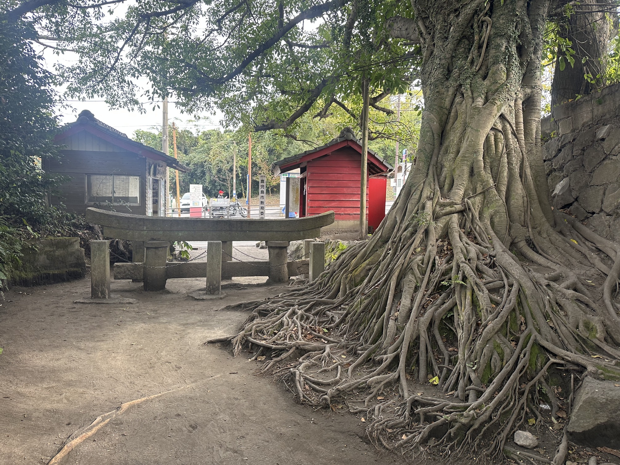
As we worked our way around the volcano there were various points of interest to stop at. One notable stop was at the site of a village that had been buried by the 1914 eruption. An information board told how the villagers knew that a big eruption was coming: in the days leading up to the big event, all their wells boiled and all the rivers were suddenly full of dead fish. The eruption covered the village up t a depth of 2 meters, and the only visible sign of the town when they ventured back was the very top of a Torii gate. It’s been left as it was, a reminder of the power of the volcano.
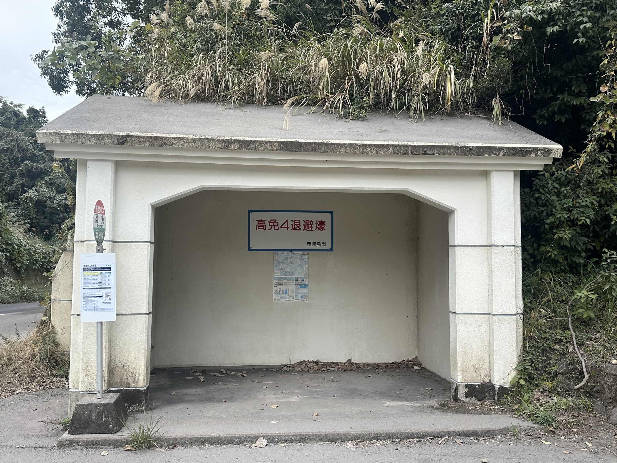
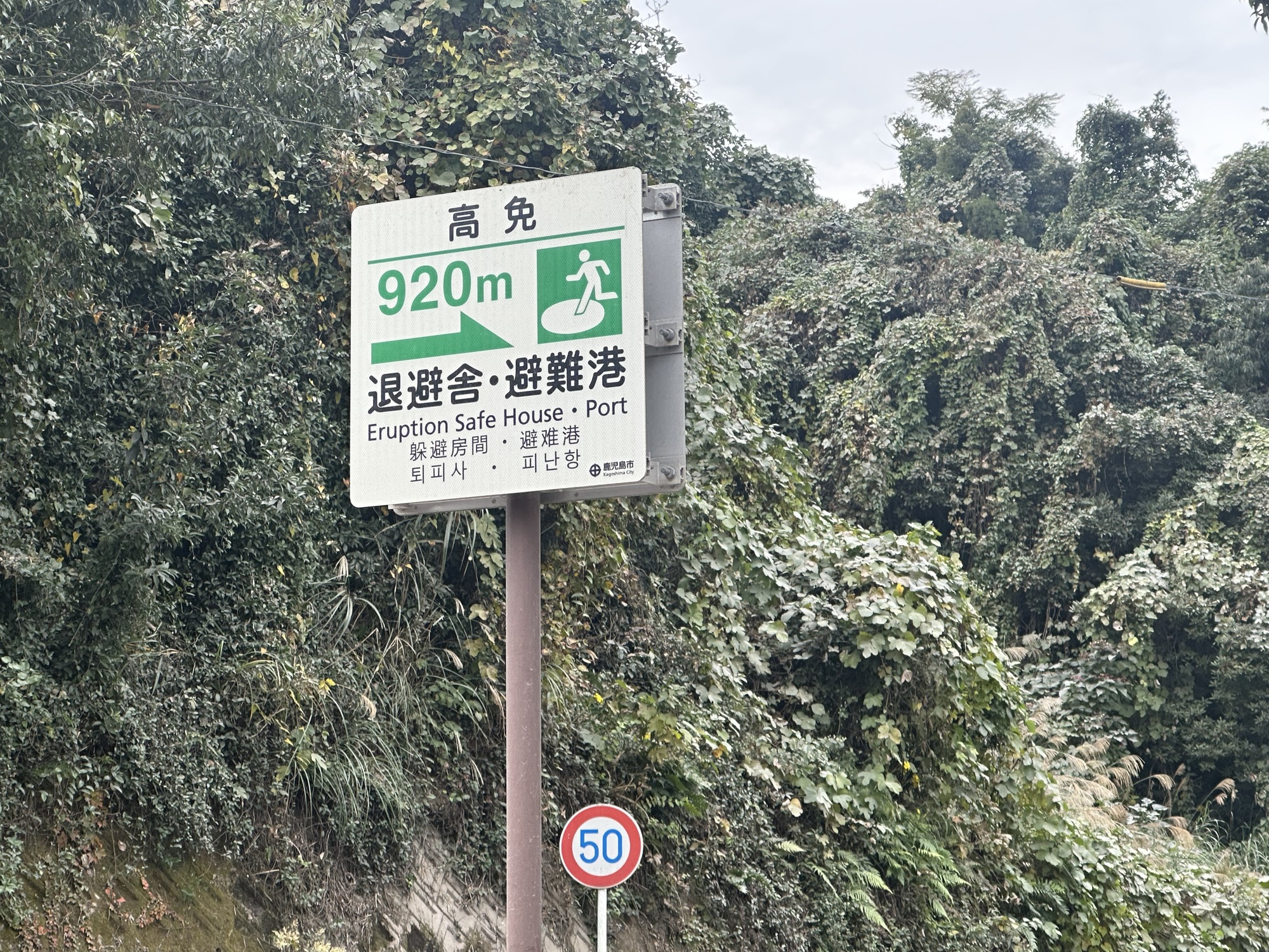
There were also eruption shelters dotted along the road at regular intervals. We were a bit sceptical about how much protection they’d offer in the event of a major eruption, but apparently there are frequent minor eruptions that send out a lot of ash. One tourist information board we saw had fun facts about living next to a volcano, which included that folks in Kagoshima have to check the wind direction before hanging out their laundry: if the wind is coming from the direction of the volcano their clothes are likely to end up covered in ash.
Overall, I was surprised at how populated the island was. We rode through several little towns on our hilly circumnavigation, passing schools and businesses and farms. It must take a certain amount of fatalism to live on the slopes of an active volcano.
A short ferry trip back to town, and soon enough we were ensconced again in our little apartment (although not quite as soon as we’d thought when we set out — it turned into pretty much a full day ride). We were planning on an early night, as we had a much longer ferry ride coming up the next day — heading south towards Okinawa.
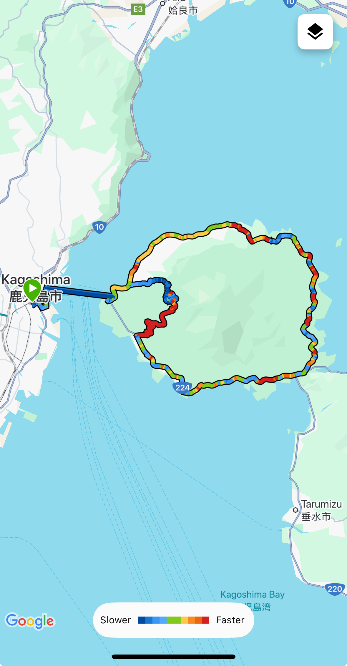
Today's ride: 40 km (25 miles)
Total: 4,562 km (2,833 miles)
| Rate this entry's writing | Heart | 4 |
| Comment on this entry | Comment | 1 |
1 month ago