November 16, 2025
Gobernader Costa to R 40 Rio Senguer Bridge
The Argentinian flag outside the hotel window hung limp on its flag-pole, meaning the wind has eased. It was time to pack my backpack and secure it on the back of the Kona, then look for breakfast. The breakfast room was empty as the woman put dubious coffee and a plate of not too fresh media lunas on my table, then two other guests, a couple in their late 40s come in with a mate thermos in hand and ask the woman to fill it with warm water.
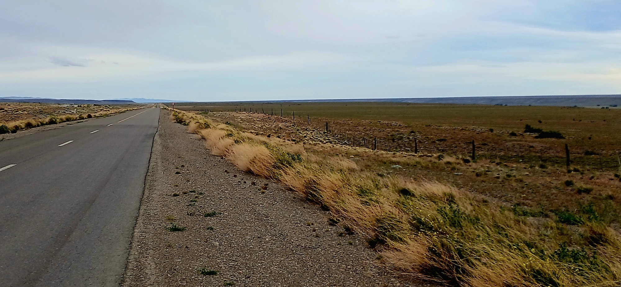
Already it is blowing a brisk breeze as I pedal along the long street of Gobernader Costa, a village on the way to places with little of interest for the passing tourist to stop for. The wind like yesterday coming from the northwest would be in my favour as Route 40 onward plots a south-southeast coarse and once past a block or two of tall popular trees surrounding estancias in windbreak, the road heads straight and melts into the sky with distant hills suspended in mid-air.
It was a day to pedal and good to be moving as I devoured the distance with 230 kilometres to Rio Mayo, the next place on the route. At one stage I see a cyclist in a red jacket ahead of me where the road turns milky, but then it seemed too big to be a cyclist. A red traffic light. The temperary type used at roadworks. The light becomes too big. Now its approaching; its actually a big red truck.
By 14 hrs I had covered 100 kilometres and have reached the one interesting feature of an otherwise dull itinery, where the road goes downhill past the derelict La Laurita roadhouse and swings left across a wide scrubland valley, over a dry river and then curves around as it climbs the hillside on the other side. I ride off the road at the dry river, down to the sheltered side of the culvert to lunch on crackers and cheese with water boiled for mate. I also set the solar-charger up and charge the phone up to 100 percent as the sun was quite strong.
I set off again, climbing the hill, struggling against a crosswind for a few kilometres before the road swung left to follow the customary south-southeast. The sky had latterly become extremely dull as a haze of dark blue cloud blew in as the wind got stronger. And the road surface which had many potholes, deteriorated further. Vehicles had slowed down and weaved around to find the most intact surface. Even the big Chilean trucks that use the route were reduced to walking pace as they negotiated their way around an assault coarse of broken road surface. Some remained on the road while others took to temporary gravel lanes either side.
I reached another roadhouse called Los Tamariscos at 17 hrs where I filled a bottle of water and rested in the shelter of the garden while drinking some. I couldn't buy anything as they only except cash.
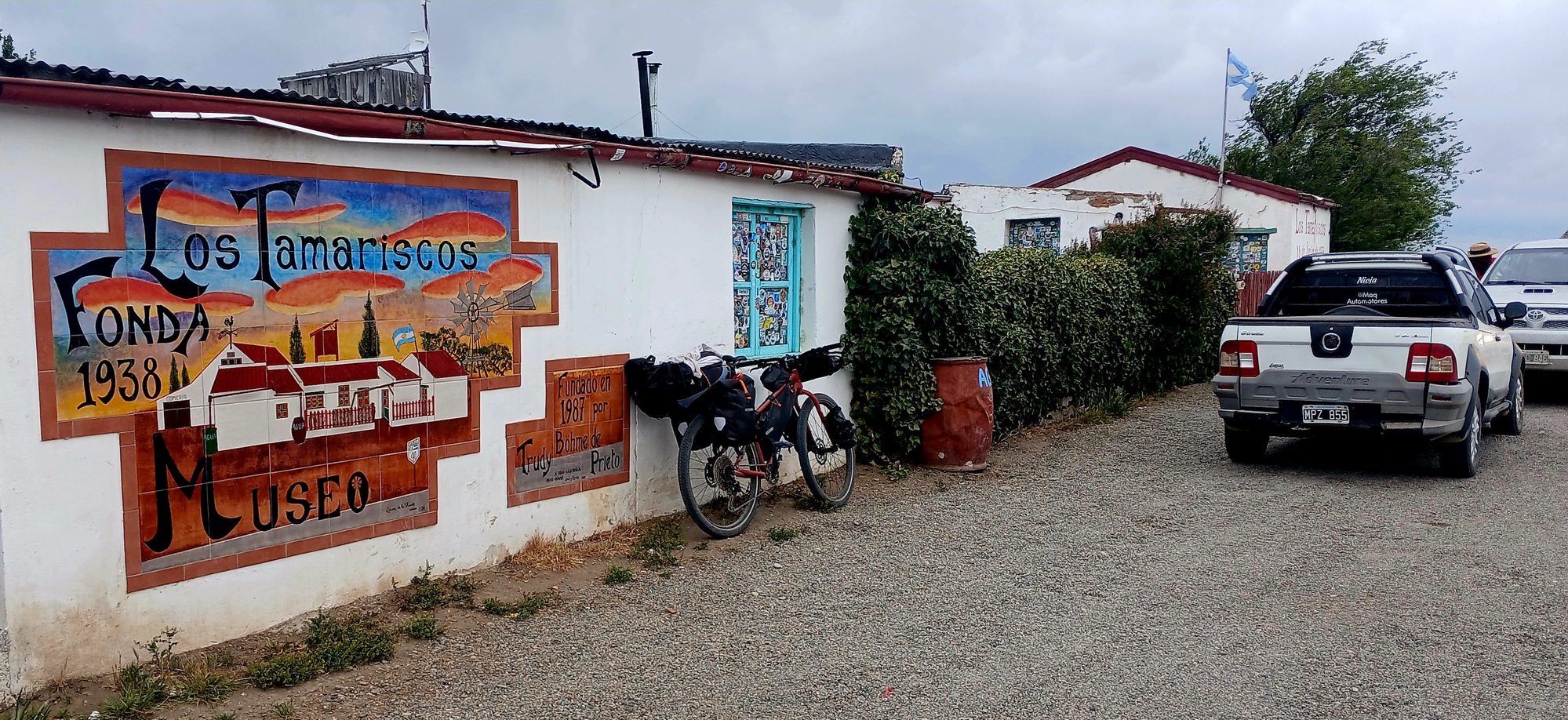
I felt the cold setting off again. Fifteen minutes stop meant I'd cooled down and I could feel the windchill as I rode away from Los Tamariscos. The sign for onward locations has EMP Ruta 26 51 km (the junction with the 26). The road continues as Route 26 in 51 kilometre while the 40 turns off right. And my phone shows 17.15 means I'll make it there well before nightfall. Good news as 40 continues from the turn off a kilometre west before going downhill into the Rio Senguir valley and over a long bridge with a track down to the riverbank with good wild camping opportunities.
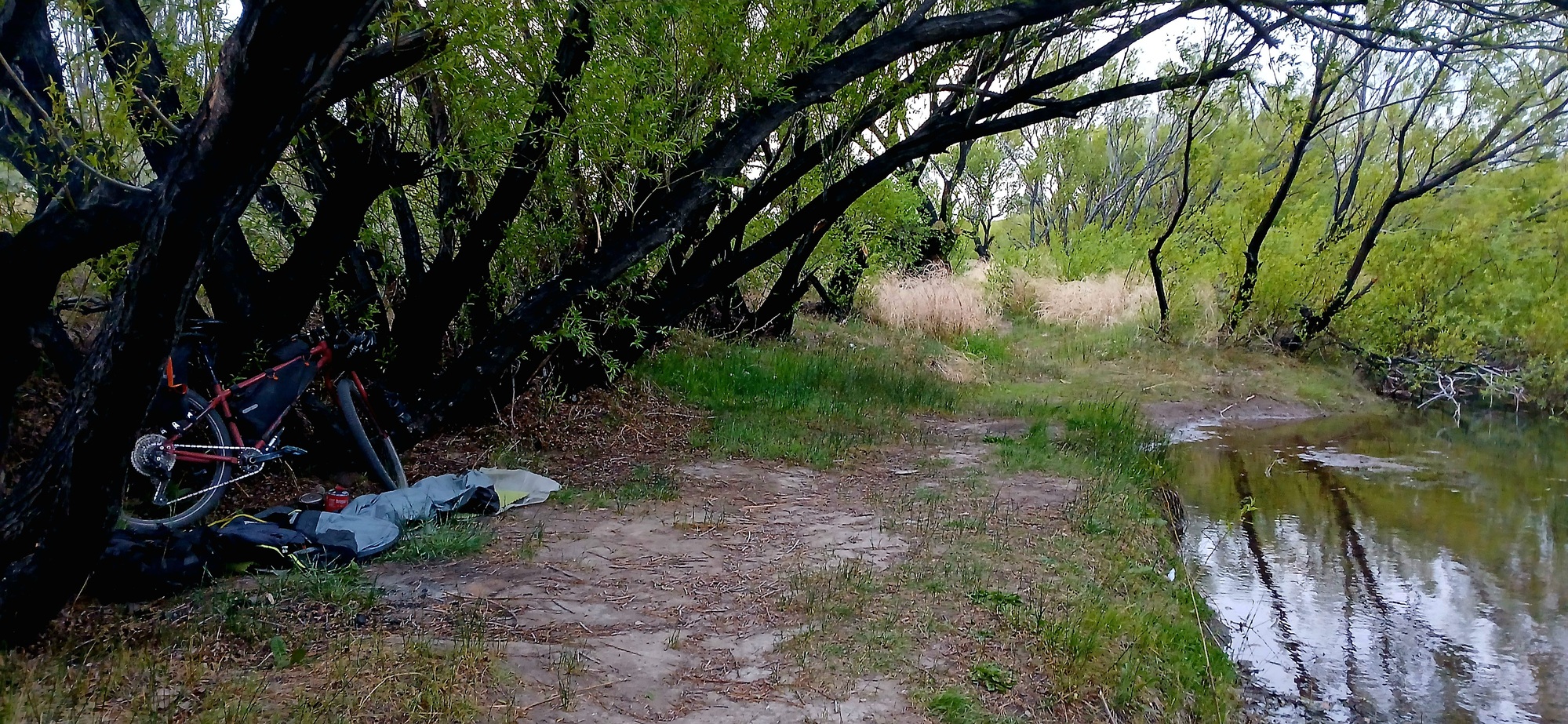
It took three hours to cover the distance and as the 40 veered left leaving 26 that continues to the coast, the wind had eased a little as I rode west and the sun made an appearance as I descended before going down behind the hill rising from the riverbank of Rio Senguer.
I crossover the bridge and descend the track to the riverbank where I quickly set up camp in a grove of willowy riverside trees, have a quick supper of soup and crackers before settling into the bivouac to sleep.
| Rate this entry's writing | Heart | 3 |
| Comment on this entry | Comment | 0 |